
As I said earlier, at this point drone pictures and other aerial photography is best as many streets are now flooded or blocked.
It is still possible to get to the Stoner Boat Launch though, which was my first stop today. To give a sense of perspective, this image from Google shows what the area normally looks like:
 |
| Stoner Boat Launch, Google Maps |
You can see the Clyde Fant Parkway north and south bound over to the left. The parking lot at the top left is the VA overflow parking lot and parking for the Skate Plaza which you see next to the parking lot. Right now, if you drew a vertical line from the skate park straight down, everything to the right of that line is now water.
So, with that blue pavilion as a point of reference, here's the parking lot which is now a fishing pond:
 |
| Stoner Boat Launch, 6/5/2015 |
People were catching some very large fish out of there today.
 |
| Stoner Boat Launch, 6/5/2015 |
 |
| Butterfly! |
 |
| High water; Stoner Boat Launch |
And the Clyde Fant Parkway is closed.
 |
| Turn around. |
Undaunted, I put the shoe leather to work...
 |
| Clyde Fant Parkway, facing north |
 |
| East and west sides of Parkway under water. |
 |
| End of the road... |
Riverview Hall is sandbagged.
 |
| Riverview Hall, 6/5/2015 |
The Parkway is closed downtown, too; the water is coming up through the drains in front of SciPort:
 |
| SciPort parking lot |
 |
| Clyde Fant Parkway, 6/5/2015 |
 |
| Riverview Park, 6/5/2015 |
The current is incredibly fast.
 |
| Red River |
 |
| Near Riverview Park |
 |
| Clyde Fant Parkway |
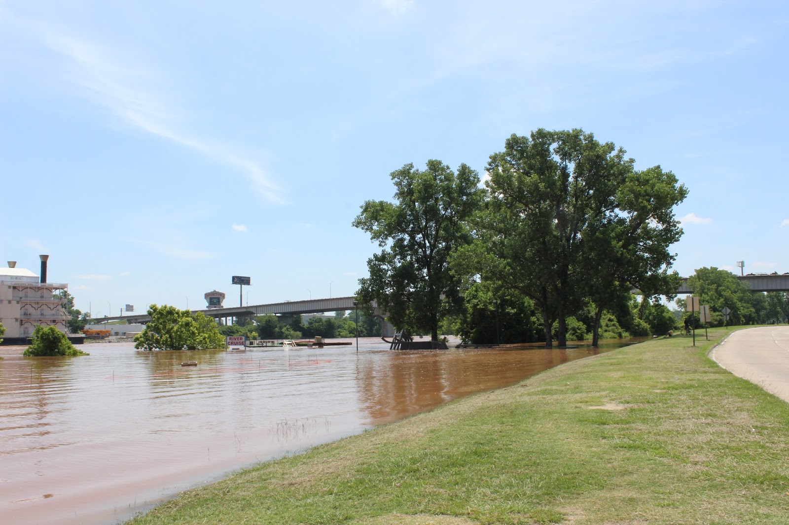
 |
| River Cruise |
 |
| SciPort sandbagged |
 |
| Clyde Fant Parkway |
 |
| Along Clyde Fant Parkway |
 |
| Clyde Fant Parkway |
 |
| Irony |
 |
| It's safe for me but not for you! Go away! |

Through the day the crest prediction was raised to 36.5.
Current levels:

Some apartment complexes are facing possible evacuation.
And, of course, Bobby Jindal was here today.
Thanks for the donations! It helps keep gas in the Jeep.
Stay dry and watch out for your neighbors. Be wary of things in the water. And there are several reports of livestock stranded as officials work rescue operations to save them. Be safe and help where you can.
Previously:
Red River Flooding Roundup June 5
Red River Flooding Photos: Part 4 (June 3)
Red River Flooding Roundup June 3
Red River Flooding Photos: Part 3 (June 1)
Red River Flooding Roundup: May 31, 2015.
Red River Flooding photos: Part 1 (May 17)
Red River Flooding Photos Part 2 (May 30)
HIT THE TIP JAR!
1 comment:
Are there gators in the river now?
Post a Comment